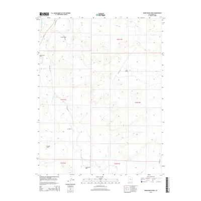
2014 Map of Horse Bench West
USGS Topo · Published 2014About this map
The San Rafael River meanders across this arid landscape, carving its way through the northeastern reaches of the San Rafael Desert. This 2014 survey documents a territory defined by deep drainages and flat-topped landforms, notably the prominent Horse Bench. While largely undeveloped, the area is accessible via a network of primitive routes like Gillis Ranch Rd and Iverson Mine Rd, which hint at the region's historic mining and ranching interests. Water sources are scarce and seasonal, marked by features such as Iron Wash, Cottonwood Wash, and Greasewood Draw. The map provides a high-resolution look at the drainage patterns and township boundaries that manage this expansive public land in Emery County.
Find a feature on this map
17 named features on this map. Tap any name to fly to it.
Don’t see what you’re looking for? This feature index may not catch every label — zoom into the map to look around manually.
Map Details
Editions of this 2014 Horse Bench West Map
This is the sole edition of this map. No revisions or reprints were ever made.
Other maps of this area

1885 · San Rafael
USGS Topo · 1:250,000

1953 · Tidwell 2 SW
USGS Topo · 1:24,000

1953 · Tidwell 3 NW
USGS Topo · 1:24,000

1953 · Tidwell 2 NW
USGS Topo · 1:24,000

1954 · Tidwell 1 SW
USGS Topo · 1:24,000

1954 · Tidwell 2 SE
USGS Topo · 1:24,000

1954 · Tidwell 2 NE
USGS Topo · 1:24,000

1954 · Tidwell 1 NW
USGS Topo · 1:24,000

1954 · Tidwell Bottoms
USGS Topo · 1:62,500

1954 · Green River
USGS Topo · 1:62,500