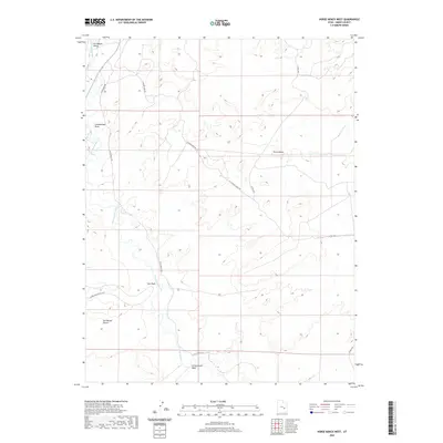
2020 Map of Horse Bench West
USGS Topo · Published 2020About this map
The San Rafael River meanders through this portion of Emery County, defining the drainage patterns of a landscape marked by high plateaus and deep washes. The prominent landform of Horse Bench dominates the central-eastern terrain, standing as a significant topographical feature above the surrounding desert floor. This 2020 survey documents the modern network of access roads essential for navigating the region's mining and ranching history, including Acerson Mine Rd and its extension, Se Acerson Mine Exn, alongside Gillis Ranch Rd. The map detail captures the intersection of the San Rafael Valley and the northern reaches of the San Rafael Desert. This area is heavily dissected by seasonal watercourses such as Iron Wash, which features the Lower Iron Wash Loop, and Cottonwood Wash, reflecting a geography shaped by intermittent flooding and erosion.
Find a feature on this map
13 named features on this map. Tap any name to fly to it.
Don’t see what you’re looking for? This feature index may not catch every label — zoom into the map to look around manually.
Map Details
Editions of this 2020 Horse Bench West Map
This is the sole edition of this map. No revisions or reprints were ever made.
Other maps of this area

1885 · San Rafael
USGS Topo · 1:250,000

1953 · Tidwell 2 SW
USGS Topo · 1:24,000

1953 · Tidwell 3 NW
USGS Topo · 1:24,000

1953 · Tidwell 2 NW
USGS Topo · 1:24,000

1954 · Tidwell 1 SW
USGS Topo · 1:24,000

1954 · Tidwell 2 SE
USGS Topo · 1:24,000

1954 · Tidwell 2 NE
USGS Topo · 1:24,000

1954 · Tidwell 1 NW
USGS Topo · 1:24,000

1954 · Tidwell Bottoms
USGS Topo · 1:62,500

1954 · Green River
USGS Topo · 1:62,500