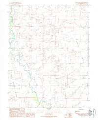
1988 Map of Horse Bench West
USGS Topo · Published 1988About this map
San Rafael River carves a winding path through the arid heart of Emery County, defining a landscape of stark contrasts and mineral potential in the late 1980s. To the east, the elevated plateau of Horse Bench dominates the horizon, while the southwestern portion of the map transitions into the expansive San Rafael Desert. The terrain is marked by numerous resource extraction attempts, including an Open Pit Mine and scattered Prospects in the northern hills. These markings reflect the region's long history of small-scale mining and exploration within the San Rafael Swell's rugged geology. Seasonal drainage patterns are recorded through features like Iron Wash and Cottonwood Wash, which represent the primary erosional forces shaping the local topography. This provisional data captures the area prior to later developments, preserving the original surveying detail of this remote Utah corridor.
Find a feature on this map
11 named features on this map. Tap any name to fly to it.
Don’t see what you’re looking for? This feature index may not catch every label — zoom into the map to look around manually.
Map Details
Editions of this 1988 Horse Bench West Map
This is the sole edition of this map. No revisions or reprints were ever made.
Other maps of this area

1885 · San Rafael
USGS Topo · 1:250,000

1953 · Tidwell 2 SW
USGS Topo · 1:24,000

1953 · Tidwell 3 NW
USGS Topo · 1:24,000

1953 · Tidwell 2 NW
USGS Topo · 1:24,000

1954 · Tidwell 1 SW
USGS Topo · 1:24,000

1954 · Tidwell 2 SE
USGS Topo · 1:24,000

1954 · Tidwell 2 NE
USGS Topo · 1:24,000

1954 · Tidwell 1 NW
USGS Topo · 1:24,000

1954 · Tidwell Bottoms
USGS Topo · 1:62,500

1954 · Green River
USGS Topo · 1:62,500