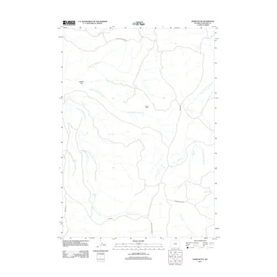
2012 Map of Horse Butte
USGS Topo · Published 2012About this map
French Vee sits at the heart of this high-plains landscape in Washakie County, where a complex network of seasonal drainages carves into the terrain. The map captures an area defined by its historical livestock routes and natural landmarks, most notably the Big Trails Stock Drive Rd which traverses the northern reaches. Water, though perhaps intermittent, dictates the geography with numerous forks of the Middle Fork Little Canyon Cr, Ferris Cr, and the S Fork Red Fork Powder River creating a series of deep draws and basins. Significant relief is provided by Horse Butte and the distinctive depression known as Mulligan Hole. Roads like Hazelton Rd and Barnum Mountain Rd suggest the primary corridors for modern access to this remote ranching and grazing country.
Find a feature on this map
20 named features on this map. Tap any name to fly to it.
Don’t see what you’re looking for? This feature index may not catch every label — zoom into the map to look around manually.
Map Details
Editions of this 2012 Horse Butte Map
This is the sole edition of this map. No revisions or reprints were ever made.
Other maps of this area
1955 · Arminto
USGS Topo · 1:250,000
1958 · Arminto
USGS Topo · 1:250,000
1962 · Arminto
USGS Topo · 1:250,000
1966 · Big Trails
USGS Topo · 1:24,000
1966 · Tallon Spring
USGS Topo · 1:24,000
1967 · Mahogany Butte
USGS Topo · 1:24,000
1967 · Tabletop
USGS Topo · 1:24,000
1967 · Horse Butte
USGS Topo · 1:24,000
1967 · Gordon Creek
USGS Topo · 1:24,000
1967 · Turk Springs
USGS Topo · 1:24,000