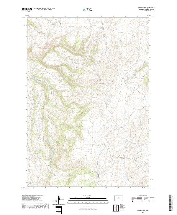
2021 Map of Horse Butte
USGS Topo · Published 2021About this map
Horse Butte rises as a central landmark in this high-elevation landscape of the Big Horn Mountains' southern extent. The drainage network is particularly intricate here, defined by the numerous branches of N Fork Little Canyon Cr and the S Fork Red Fork Powder River. This hydrological complexity suggests a terrain deeply carved by seasonal runoff, where water sources like Bear Spring provided critical stops for early travelers and livestock. Primitive routes such as Dry Farm Rd and Hazelton Rd trace the ridgelines and valleys, indicating a long-standing pattern of ranching and movement through these upland grazing territories. The name Mulligan Hole further speaks to the localized, often family-named geography of Wyoming's backlands, marking a specific basin or depression that stood out to early settlers and surveyors navigating the Washakie County terrain.
Find a feature on this map
25 named features on this map. Tap any name to fly to it.
Don’t see what you’re looking for? This feature index may not catch every label — zoom into the map to look around manually.
Map Details
Editions of this 2021 Horse Butte Map
This is the sole edition of this map. No revisions or reprints were ever made.
Other maps of this area

1955 · Arminto
USGS Topo · 1:250,000

1958 · Arminto
USGS Topo · 1:250,000

1962 · Arminto
USGS Topo · 1:250,000

1966 · Big Trails
USGS Topo · 1:24,000
1966 · Tallon Spring
USGS Topo · 1:24,000

1967 · Mahogany Butte
USGS Topo · 1:24,000
1967 · Tabletop
USGS Topo · 1:24,000

1967 · Horse Butte
USGS Topo · 1:24,000

1967 · Gordon Creek
USGS Topo · 1:24,000

1967 · Turk Springs
USGS Topo · 1:24,000