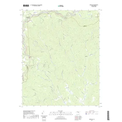
2019 Map of Horse Gap
USGS Topo · Published 2019About this map
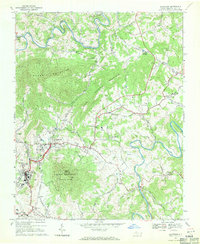
Vannoy and the surrounding high country of the Blue Ridge define this portion of the border between Ashe and Wilkes Counties. The landscape is dominated by the headwaters of the Reddies River, where the North Fork Reddies River, Middle Fork Reddies River, and S Fork Reddies River emerge from the steep drainages of Piney Ridge and Cross Mtn. The Blue Ridge Parkway winds along the northern crests, passing through Horse Gap and Sheets Gap, while the long-distance Mountains-to-Sea Trail follows the ridgeline. The area maintains a rural, forested character with sparse development, largely limited to narrow mountain roads like Old Campground Rd and Daniels Gap Dr. Landmark peaks such as Meditation Mtn and Judd Mtn provide significant vertical relief, while Moravian Camp Lake offers a rare instance of standing water in this high-elevation terrain.
Find a feature on this map
92 named features on this map. Tap any name to fly to it.
Don’t see what you’re looking for? This feature index may not catch every label — zoom into the map to look around manually.
Map Details
Editions of this 2019 Horse Gap Map
This is the sole edition of this map. No revisions or reprints were ever made.
Other maps of this area

1889 · Wilkesboro
USGS Topo · 1:125,000

1891 · Wilkesboro
USGS Topo · 1:125,000

1953 · Winston-Salem
USGS Topo · 1:250,000

1955 · Winston-Salem
USGS Topo · 1:250,000

1962 · Winston-Salem
USGS Topo · 1:250,000
1966 · Maple Springs
USGS Topo · 1:24,000

1966 · Wilkesboro
USGS Topo · 1:24,000
1966 · Purlear
USGS Topo · 1:24,000
1967 · Glendale Springs
USGS Topo · 1:24,000
1968 · Jefferson
USGS Topo · 1:24,000