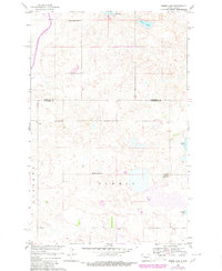
1960 Map of Horse Lake
USGS Topo · Published 1980About this map
Glacial prairie potholes and small, ephemeral water bodies define the rural landscape along the boundary of Sheridan and Burleigh counties. This 1960 survey reflects a period of established township organization, where public education and community life centered on distributed district buildings. Notable landmarks include the Johns Lake Ch and a network of numbered rural schools such as Johns Lake Sch No 3, Schrunk Sch No 1, and Schrunk Sch No 2.
Find a feature on this map
11 named features on this map. Tap any name to fly to it.
Don’t see what you’re looking for? This feature index may not catch every label — zoom into the map to look around manually.
Map Details
Editions of this 1960 Horse Lake Map
2 editions found
Other maps of this area

1954 · McClusky
USGS Topo · 1:250,000

1958 · McClusky
USGS Topo · 1:250,000

1959 · Pickardville
USGS Topo · 1:24,000

1959 · Mercer SE
USGS Topo · 1:24,000

1959 · McClusky
USGS Topo · 1:24,000

1960 · Horse Lake
USGS Topo · 1:24,000

1960 · Florence Lake
USGS Topo · 1:24,000

1960 · Denhoff
USGS Topo · 1:24,000
1979 · Regan
USGS Topo · 1:24,000

1979 · Canfield Lake
USGS Topo · 1:24,000