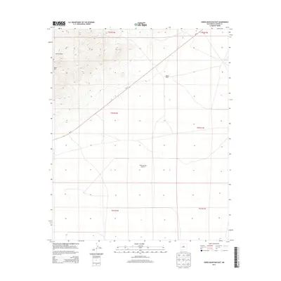
2013 Map of Horse Mountain East
USGS Topo · Published 2013About this map
Horse Mtn dominates the northwestern corner of this West-Central New Mexico landscape, marking the transition from rugged high-elevation terrain into the broad, flat expanse of the Plains of San Agustin. This high desert environment is characterized by dramatic drainage systems like Nance Canyon and the winding Nester Draw, which cut through the arid terrain. The map captures the area's sparse infrastructure, defined largely by the diagonal route of Nm-12 as it crosses the plains. This 2013 survey provides a clear view of the Public Land Survey System grid, detailing sections across the vast open country of Catron County. The arrangement of township and range lines reveals a landscape primarily shaped by large-scale ranching and environmental management rather than dense settlement, offering researchers a precise look at modern land boundaries in this segment of the Southwest.
Find a feature on this map
11 named features on this map. Tap any name to fly to it.
Don’t see what you’re looking for? This feature index may not catch every label — zoom into the map to look around manually.
Map Details
Editions of this 2013 Horse Mountain East Map
This is the sole edition of this map. No revisions or reprints were ever made.
Other maps of this area

1918 · Pelona
USGS Topo · 1:125,000

1954 · Tularosa
USGS Topo · 1:250,000

1954 · Clifton
USGS Topo · 1:250,000

1954 · Saint Johns
USGS Topo · 1:250,000

1954 · Socorro
USGS Topo · 1:250,000

1957 · Clifton
USGS Topo · 1:250,000

1957 · Saint Johns
USGS Topo · 1:250,000

1958 · Socorro
USGS Topo · 1:250,000

1958 · Clifton
USGS Topo · 1:250,000

1958 · Tularosa
USGS Topo · 1:250,000