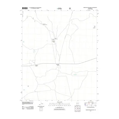
2011 Map of Horse Mountain West
USGS Topo · Published 2011About this map
Old Horse Springs and New Horse Springs anchor the human presence in this high-altitude landscape of Catron County, where water is the primary driver of names and movement. The drainage network of Alamocito Creek dominates the center of the sheet, carving out North Fork Alamocito Canyon, South Fork Alamocito Canyon, and the sheer-walled White Rock Canyon. These geographic features imply a history of range management, reinforced by the distribution of remote water sources like Upper West Pasture Spring, Lower West Pasture Spring, and Rock Tank.
Find a feature on this map
18 named features on this map. Tap any name to fly to it.
Don’t see what you’re looking for? This feature index may not catch every label — zoom into the map to look around manually.
Map Details
Editions of this 2011 Horse Mountain West Map
This is the sole edition of this map. No revisions or reprints were ever made.
Other maps of this area

1918 · Pelona
USGS Topo · 1:125,000

1954 · Clifton
USGS Topo · 1:250,000

1954 · Saint Johns
USGS Topo · 1:250,000

1957 · Clifton
USGS Topo · 1:250,000

1957 · Saint Johns
USGS Topo · 1:250,000

1958 · Clifton
USGS Topo · 1:250,000

1958 · Saint Johns
USGS Topo · 1:250,000

1962 · Clifton
USGS Topo · 1:250,000

1962 · Saint Johns
USGS Topo · 1:250,000

1981 · Fullerton
USGS Topo · 1:24,000