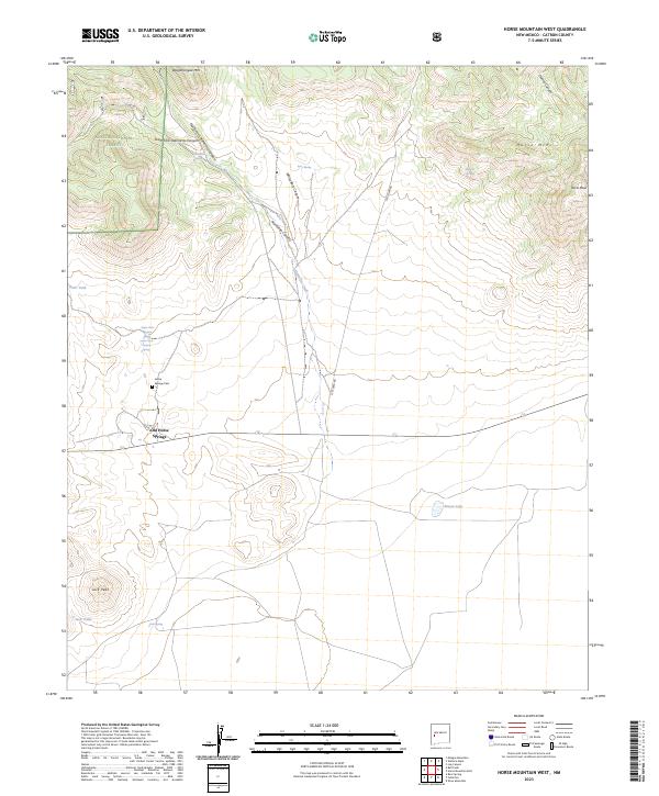
2023 Map of Horse Mountain West
USGS Topo · Published 2023About this map
Old Horse Springs serves as a central landmark in this high-elevation corner of Catron County, where the landscape transitions from the volcanic heights of Horse Mountain and Wagontongue Mountain into the drainage basins of Alamocito Creek. The map captures a region defined by its water sources and livestock history, evidenced by features like the Horse Springs Cemetery and a network of seasonal catchments including Rock Tank and Jack Tank.
Find a feature on this map
31 named features on this map. Tap any name to fly to it.
Don’t see what you’re looking for? This feature index may not catch every label — zoom into the map to look around manually.
Map Details
Editions of this 2023 Horse Mountain West Map
This is the sole edition of this map. No revisions or reprints were ever made.
Other maps of this area

1918 · Pelona
USGS Topo · 1:125,000

1954 · Clifton
USGS Topo · 1:250,000

1954 · Saint Johns
USGS Topo · 1:250,000

1957 · Clifton
USGS Topo · 1:250,000

1957 · Saint Johns
USGS Topo · 1:250,000

1958 · Clifton
USGS Topo · 1:250,000

1958 · Saint Johns
USGS Topo · 1:250,000

1962 · Clifton
USGS Topo · 1:250,000

1962 · Saint Johns
USGS Topo · 1:250,000

1981 · Fullerton
USGS Topo · 1:24,000