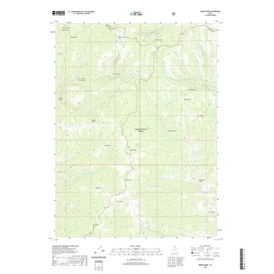
2020 Map of Horse Ridge
USGS Topo · Published 2020About this map
Cache National Forest dominates this section of the northern Wasatch Range, where a complex network of ridges and canyons defines the watershed for several major river forks. The topography is shaped by the headwaters of the Left Fork S Fork Ogden River and the Right Fork S Fork Ogden River, which converge amidst high-elevation landmarks like Horse Ridge and Knighton Ridge. The map reveals a history of land use through place names such as Sawmill Canyon, suggesting early timber operations that once supported the surrounding valleys.
Find a feature on this map
34 named features on this map. Tap any name to fly to it.
Don’t see what you’re looking for? This feature index may not catch every label — zoom into the map to look around manually.
Map Details
Editions of this 2020 Horse Ridge Map
This is the sole edition of this map. No revisions or reprints were ever made.
Other maps of this area

1954 · Ogden
USGS Topo · 1:250,000

1958 · Ogden
USGS Topo · 1:250,000

1960 · Ogden
USGS Topo · 1:250,000

1961 · Morgan
USGS Topo · 1:62,500

1964 · Lost Creek Dam
USGS Topo · 1:24,000

1964 · Monte Cristo PK
USGS Topo · 1:24,000

1964 · Francis Canyon
USGS Topo · 1:24,000
1964 · Causey Dam
USGS Topo · 1:24,000

1968 · Horse Ridge
USGS Topo · 1:24,000

1968 · Dairy Ridge
USGS Topo · 1:24,000