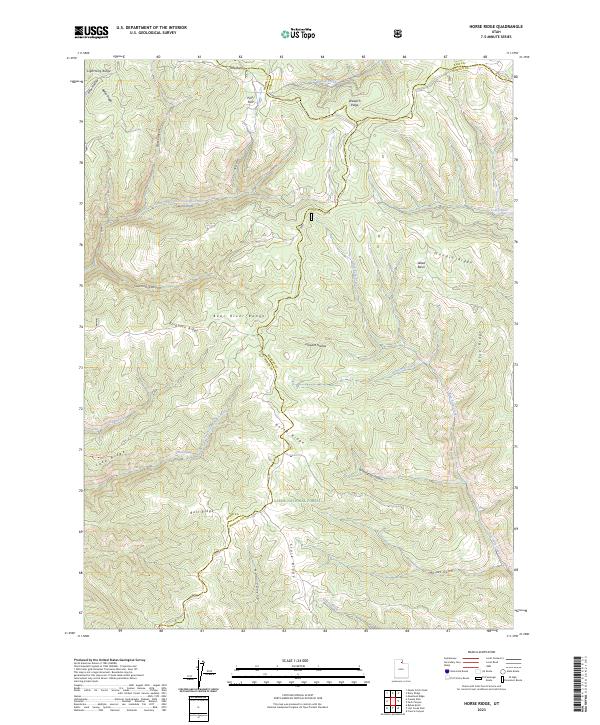
2023 Map of Horse Ridge
USGS Topo · Published 2023About this map
Cache National Forest encompasses the high country of the Bear River Range in this recent survey of the borderlands where Weber, Rich, and Morgan counties meet. The landscape is defined by its drainage systems, notably the Left Fork South Fork Ogden River and Right Fork South Fork Ogden River which carve through canyons like Sawmill Canyon and Bear Canyon. Historical usage of the land is hinted at by the network of ridges including Lightning Ridge, Horse Ridge, and Stark Ridge, which serve as natural divides between significant water sources such as Woodruff Creek and Lost Creek. Recreation and passage through this elevated terrain are marked by the Lake Ridge Trl, while isolated features like Wonder Spring provide specific points of interest for those studying the hydrology of the northern Wasatch area.
Find a feature on this map
37 named features on this map. Tap any name to fly to it.
Don’t see what you’re looking for? This feature index may not catch every label — zoom into the map to look around manually.
Map Details
Editions of this 2023 Horse Ridge Map
This is the sole edition of this map. No revisions or reprints were ever made.
Other maps of this area

1954 · Ogden
USGS Topo · 1:250,000

1958 · Ogden
USGS Topo · 1:250,000

1960 · Ogden
USGS Topo · 1:250,000

1961 · Morgan
USGS Topo · 1:62,500

1964 · Lost Creek Dam
USGS Topo · 1:24,000

1964 · Monte Cristo PK
USGS Topo · 1:24,000

1964 · Francis Canyon
USGS Topo · 1:24,000
1964 · Causey Dam
USGS Topo · 1:24,000

1968 · Horse Ridge
USGS Topo · 1:24,000

1968 · Dairy Ridge
USGS Topo · 1:24,000