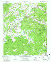
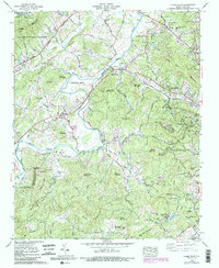
1965 Map of Horse Shoe
USGS Topo · Published 1979About this map
The French Broad River carves a distinctive path through this corner of the Blue Ridge, creating the namesake Horse Shoe Bend and a fertile valley floor long favored for settlement. By the mid-1960s, the landscape reflects a transition from traditional rural life to recreation and suburban expansion, as seen in the development of Woodland Hills and Sky Village. The river is spanned by several crossings, including Johnson Bridge and McLean Bridge, which serve as vital connectors for the surrounding hills and ridges.
Find a feature on this map
92 named features on this map. Tap any name to fly to it.
Don’t see what you’re looking for? This feature index may not catch every label — zoom into the map to look around manually.
Map Details
Editions of this 1965 Horse Shoe Map
5 editions found
Other maps of this area

1905 · Pisgah
USGS Topo · 1:125,000

1906 · Pisgah
USGS Topo · 1:125,000

1907 · Saluda
USGS Topo · 1:125,000

1935 · Brevard
USGS Topo · 1:24,000

1935 · Standingstone Mtn.
USGS Topo · 1:24,000

1935 · Horse Shoe
USGS Topo · 1:24,000

1935 · Hendersonville
USGS Topo · 1:24,000

1935 · Zirconia
USGS Topo · 1:24,000

1935 · Pisgah Forest
USGS Topo · 1:24,000

1936 · Skyland
USGS Topo · 1:24,000