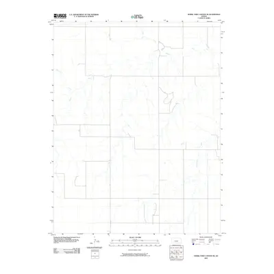
2009 Map of Horse Thief Canyon NE
USGS Topo · Published 2009About this map
The Pawnee River meanders across the northern plains of Hodgeman County, creating a distinctive hydrological network in this section of western Kansas. This 2009 survey by the U.S. Geological Survey documents a landscape defined by its drainages, where the main river is fed by several named tributaries including Hackberry Creek and Plum Creek. The terrain is characterized by the broad alluvial valleys of these waterways, which cut through the agricultural tablelands common to the region. In the southeast, Cottonwood Creek drains the local slopes, illustrating the complex watershed system that sustained early ranching and farming operations in the area. The map provides a precise layout of the section lines and local roads that follow the grid-based settlement patterns of the Great Plains, showing how modern infrastructure continues to respect the natural flow of these ancient prairie streams.
Find a feature on this map
4 named features on this map. Tap any name to fly to it.
Don’t see what you’re looking for? This feature index may not catch every label — zoom into the map to look around manually.
Map Details
Editions of this 2009 Horse Thief Canyon NE Map
This is the sole edition of this map. No revisions or reprints were ever made.
Other maps of this area

1892 · Ness
USGS Topo · 1:125,000

1894 · Ness
USGS Topo · 1:125,000

1955 · Great Bend
USGS Topo · 1:250,000

1955 · Scott City
USGS Topo · 1:250,000

1957 · Great Bend
USGS Topo · 1:250,000

1958 · Great Bend
USGS Topo · 1:250,000

1958 · Scott City
USGS Topo · 1:250,000

1969 · Jetmore
USGS Topo · 1:24,000
1970 · Jetmore NW
USGS Topo · 1:24,000
1970 · Horse Thief Canyon
USGS Topo · 1:24,000