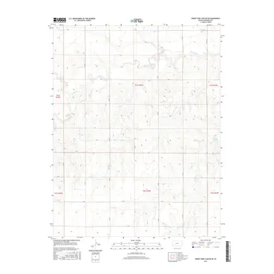
2015 Map of Horse Thief Canyon NE
USGS Topo · Published 2015About this map
The Pawnee River meanders across the northern portion of this Hodgeman County landscape, creating a distinct topographical corridor through the high plains of western Kansas. This 2015 survey reveals a land defined by its drainage systems and a rigorous section-line road grid. Tributaries such as Hackberry Cr and Plum Cr feed into the river valley, while Cottonwood Cr drains the southeastern reaches. The map is a study in rural geometry, where labels like S RD, V RD, and 211 RD represent the essential infrastructure connecting the isolated farmsteads and agricultural tracts typical of this region. The lack of concentrated settlements highlights the expansive nature of Kansas ranching and farming at the start of the twenty-first century.
Find a feature on this map
25 named features on this map. Tap any name to fly to it.
Don’t see what you’re looking for? This feature index may not catch every label — zoom into the map to look around manually.
Map Details
Editions of this 2015 Horse Thief Canyon NE Map
This is the sole edition of this map. No revisions or reprints were ever made.
Other maps of this area

1892 · Ness
USGS Topo · 1:125,000

1894 · Ness
USGS Topo · 1:125,000

1955 · Great Bend
USGS Topo · 1:250,000

1955 · Scott City
USGS Topo · 1:250,000

1957 · Great Bend
USGS Topo · 1:250,000

1958 · Great Bend
USGS Topo · 1:250,000

1958 · Scott City
USGS Topo · 1:250,000

1969 · Jetmore
USGS Topo · 1:24,000
1970 · Jetmore NW
USGS Topo · 1:24,000
1970 · Horse Thief Canyon
USGS Topo · 1:24,000