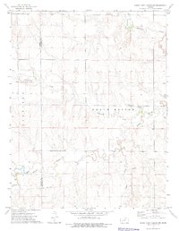
1974 Map of Horse Thief Canyon NW
USGS Topo · Published 1976About this map
North Roscoe and Garfield townships characterize this western Kansas landscape during the mid-1970s. The terrain is defined by the winding course of the Pawnee River and its tributaries, including Hackberry Creek and Cottonwood Creek. The rural community life of the era is anchored at the intersection of local history and gathering, evidenced by the Kitterville Community Hall and the nearby Kitterville Cem. This survey reflects a sparsely populated agricultural region where section lines dictate the movement of people and resources, and the presence of a Pipeline suggests the infrastructure of the modern energy economy cutting across the open plains. In addition to the major watercourses, numerous small wells and intermittent Sand Creek drainages show the vital importance of water management in this arid prairie environment.
Find a feature on this map
12 named features on this map. Tap any name to fly to it.
Don’t see what you’re looking for? This feature index may not catch every label — zoom into the map to look around manually.
Map Details
Editions of this 1974 Horse Thief Canyon NW Map
This is the sole edition of this map. No revisions or reprints were ever made.
Other maps of this area

1955 · Scott City
USGS Topo · 1:250,000

1958 · Scott City
USGS Topo · 1:250,000
1970 · Horse Thief Canyon
USGS Topo · 1:24,000
1974 · Horse Thief Canyon SW
USGS Topo · 1:24,000
1974 · Kalvesta
USGS Topo · 1:24,000
1974 · Horse Thief Canyon NE
USGS Topo · 1:24,000
1974 · Beeler SE
USGS Topo · 1:24,000

1974 · Hay Canyon
USGS Topo · 1:24,000

1974 · Beeler SW
USGS Topo · 1:24,000

1974 · Dighton SE
USGS Topo · 1:24,000