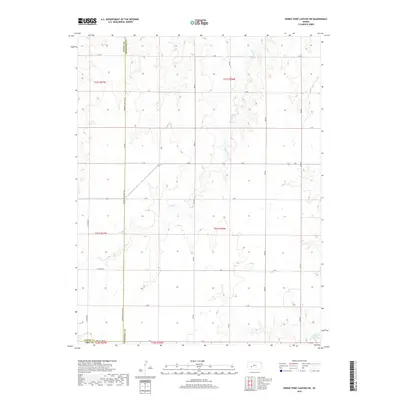
2018 Map of Horse Thief Canyon SW
USGS Topo · Published 2018About this map
The agricultural landscape of Western Kansas is defined here by the intersection of Finney, Hodgeman, and Gray counties. The terrain is structured by the Public Land Survey System, with sectional roads like Hodgeman Co Line Rd and N Woods Rd following a strict grid across the prairie. The most significant drainage is Sand Cr, which carves narrow, meandering paths through the townships of t22s r26w and t23s r26w. In the southeast corner, the headwaters of Buckner Creek appear, cutting through the section lines. This area represents a classic example of High Plains geography, where water sources like Sand Creek dictate the local topography amidst a vast network of rural routes, including E Oyler Rd and G Rd.
Find a feature on this map
28 named features on this map. Tap any name to fly to it.
Don’t see what you’re looking for? This feature index may not catch every label — zoom into the map to look around manually.
Map Details
Editions of this 2018 Horse Thief Canyon SW Map
This is the sole edition of this map. No revisions or reprints were ever made.
Other maps of this area

1892 · Dodge
USGS Topo · 1:125,000

1955 · Dodge City
USGS Topo · 1:250,000

1955 · Scott City
USGS Topo · 1:250,000

1958 · Dodge City
USGS Topo · 1:250,000

1958 · Scott City
USGS Topo · 1:250,000

1959 · Dodge City
USGS Topo · 1:250,000

1968 · Dodge City NE
USGS Topo · 1:24,000

1968 · Dodge City NW
USGS Topo · 1:24,000

1968 · Cimarron NE
USGS Topo · 1:24,000
1970 · Horse Thief Canyon
USGS Topo · 1:24,000