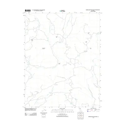
2012 Map of Horsecamp Mountain
USGS Topo · Published 2012About this map
Horsecamp Mountain anchors this landscape of Madera County, where the headwaters of the Chowchilla River and Fresno River carve through a complex network of gulches and flats. The map documents a rural transition zone where traditional ranching life, evidenced by the Grupe Ranch Airport, meets the echoes of earlier eras along the Old Wagon Rd. Topographic features like Grub Gulch, Bailey Flats, and Leland Gulch suggest a history of early prospecting and grazing. To the south, the Summit House sits near the divide of North Br Willow Cr, while the eastern edge is traced by the Mother Lode Trl, a name evoking the region's gold-bearing heritage. This 2012 survey captures the persistent rural character of the Sierra Nevada foothills through its naming of specific springs, such as Specimen Springs, and family-named routes like Polk Ranch Rd.
Find a feature on this map
43 named features on this map. Tap any name to fly to it.
Don’t see what you’re looking for? This feature index may not catch every label — zoom into the map to look around manually.
Map Details
Editions of this 2012 Horsecamp Mountain Map
This is the sole edition of this map. No revisions or reprints were ever made.
Other maps of this area

1912 · Mariposa
USGS Topo · 1:125,000

1942 · Raymond
USGS Topo · 1:62,500

1942 · Millerton Lake
USGS Topo · 1:62,500

1944 · Raymond
USGS Topo · 1:62,500

1945 · Millerton Lake
USGS Topo · 1:62,500

1947 · Mariposa
USGS Topo · 1:24,000

1947 · Mariposa
USGS Topo · 1:250,000

1947 · Mariposa
USGS Topo · 1:62,500
1947 · Stumpfield Mtn.
USGS Topo · 1:24,000
1947 · Ben Hur
USGS Topo · 1:24,000