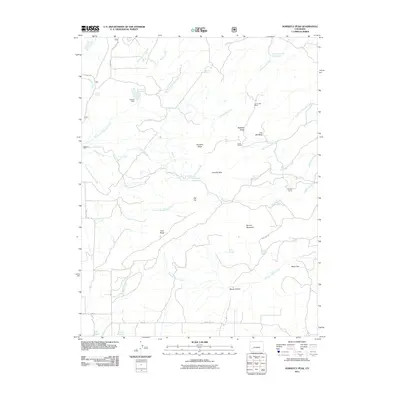
2011 Map of Horsefly Peak
USGS Topo · Published 2011About this map
Horsefly Peak dominates this high-altitude landscape in Montrose County, where the hydrology of the Uncompahgre Plateau is defined by the branching forks of Horsefly Creek. The map documents a working landscape of ranching and mining history, notably at Liberty Bell Mines and Hofmann Ranch. Water management is central to the area's utility, evidenced by a series of reservoirs and tanks including Paxton Reservoir, Hofmann Reservoir, and Cottonwood Reservoir. The terrain is characterized by prominent flat-topped features like Log Hill Mesa and Flat Top, separated by drainages such as Pleasant Valley Creek and McKenzie Creek. Scattered campsites like Phillips Camp and Hot T Camp suggest the seasonal use of these ridges. This 2011 survey captures the network of mountain roads, including Dave Wood Rd and Divide Rd, that provide access to these remote Colorado uplands.
Find a feature on this map
47 named features on this map. Tap any name to fly to it.
Don’t see what you’re looking for? This feature index may not catch every label — zoom into the map to look around manually.
Map Details
Editions of this 2011 Horsefly Peak Map
This is the sole edition of this map. No revisions or reprints were ever made.
Other maps of this area

1909 · Montrose
USGS Topo · 1:125,000

1911 · Montrose
USGS Topo · 1:125,000

1953 · Placerville
USGS Topo · 1:24,000

1956 · Montrose
USGS Topo · 1:250,000

1956 · Moab
USGS Topo · 1:250,000

1959 · Moab
USGS Topo · 1:250,000

1959 · Montrose
USGS Topo · 1:250,000

1960 · Montrose
USGS Topo · 1:250,000

1960 · Moab
USGS Topo · 1:250,000

1962 · Moab
USGS Topo · 1:250,000