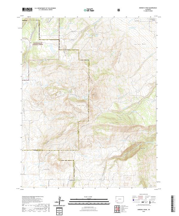
2022 Map of Horsefly Peak
USGS Topo · Published 2022About this map
The Uncompahgre National Forest dominates this high-altitude landscape where the borders of Montrose, Ouray, and San Miguel counties converge. Central to the topography is the prominent Horsefly Peak, which anchors a complex network of ridges including Horsefly Ridge, Sagehen Ridge, and Hull Ridge. The area is defined by its water management history, evidenced by numerous high-country storage sites like Cottonwood Reservoir, Hofmann Reservoir, and Paxton Reservoir, alongside natural features like Natural Pond.
Find a feature on this map
71 named features on this map. Tap any name to fly to it.
Don’t see what you’re looking for? This feature index may not catch every label — zoom into the map to look around manually.
Map Details
Editions of this 2022 Horsefly Peak Map
This is the sole edition of this map. No revisions or reprints were ever made.
Other maps of this area

1909 · Montrose
USGS Topo · 1:125,000

1911 · Montrose
USGS Topo · 1:125,000

1953 · Placerville
USGS Topo · 1:24,000

1956 · Montrose
USGS Topo · 1:250,000

1956 · Moab
USGS Topo · 1:250,000

1959 · Moab
USGS Topo · 1:250,000

1959 · Montrose
USGS Topo · 1:250,000

1960 · Montrose
USGS Topo · 1:250,000

1960 · Moab
USGS Topo · 1:250,000

1962 · Moab
USGS Topo · 1:250,000