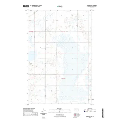
2020 Map of Horsehead Lake
USGS Topo · Published 2020About this map
Horsehead Lake dominates the central landscape of this rural Kidder County region, revealing a sprawling wetland and water system characteristic of the North Dakota prairie. The map shows the intricate boundaries of these water bodies, including Cherry Lake in the northwest, which are set against the rigid Section-Line grid of the Public Land Survey System. For those tracing family ties to the area, Kleve Cem stands as a quiet landmark along 21st St SE. The terrain is defined by the townships of t142n r73w, t142n r72w, t141n r73w, and t141n r72w, where a network of gravel roads like 31st Ave SE and 24th St SE provide access to the remote sections of this high plains country.
Find a feature on this map
21 named features on this map. Tap any name to fly to it.
Don’t see what you’re looking for? This feature index may not catch every label — zoom into the map to look around manually.
Map Details
Editions of this 2020 Horsehead Lake Map
This is the sole edition of this map. No revisions or reprints were ever made.
Other maps of this area

1952 · Tappen North
USGS Topo · 1:24,000

1952 · Steele NE
USGS Topo · 1:24,000

1952 · Steele NW
USGS Topo · 1:24,000

1952 · New Rockford
USGS Topo · 1:250,000

1953 · Jamestown
USGS Topo · 1:250,000

1956 · New Rockford
USGS Topo · 1:250,000

1956 · Jamestown
USGS Topo · 1:250,000

1971 · New Rockford
USGS Topo · 1:250,000

1972 · Tuttle
USGS Topo · 1:24,000

1972 · Kunkel Lake
USGS Topo · 1:24,000