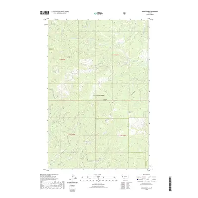
2020 Map of Horsehead Peak
USGS Topo · Published 2020About this map
Lolo National Forest encompasses this section of the Northern Rockies, where the high ridgelines of the Ninemile Divide and One Two Ridge shape the watershed. The landscape is defined by a dense network of watercourses, including Ninemile Cr and its many tributaries like Beecher Cr and Saint Louis Cr. These drainages create a complex system of V-shaped valleys and prominent spurs, such as Lower Second Ridge and the heights of Horsehead Peak.
Find a feature on this map
44 named features on this map. Tap any name to fly to it.
Don’t see what you’re looking for? This feature index may not catch every label — zoom into the map to look around manually.
Map Details
Editions of this 2020 Horsehead Peak Map
This is the sole edition of this map. No revisions or reprints were ever made.
Other maps of this area

1956 · Wallace
USGS Topo · 1:250,000

1959 · Tarkio
USGS Topo · 1:62,500

1959 · Perma
USGS Topo · 1:62,500

1959 · Plains
USGS Topo · 1:62,500

1960 · Wallace
USGS Topo · 1:250,000

1960 · Superior
USGS Topo · 1:62,500

1983 · Horsehead Peak
USGS Topo · 1:24,000
1983 · Tarkio
USGS Topo · 1:24,000
1983 · Stark South
USGS Topo · 1:24,000

1984 · Stark North
USGS Topo · 1:24,000