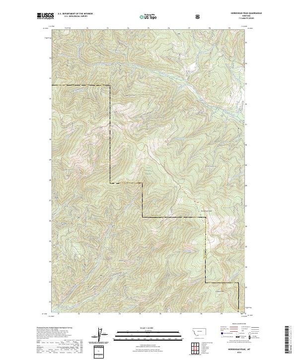
2024 Map of Horsehead Peak
USGS Topo · Published 2024About this map
Lolo National Forest dominates this section of the Northern Rockies, where the border between Missoula and Mineral counties follows the high ridgelines. The geography is defined by the Ninemile Divide, a prominent crest that dictates the flow of numerous drainages including Ninemile Creek, Burnt Fork Creek, and Devils Creek. This 2024 survey documents the modern forest management network, featuring a dense system of timber and access routes such as Upper Ninemile Rd and the Ninemile Divide Trl. These trails and roads navigate the steep elevation changes between summits like Horsehead Peak and Lookout Mtn. The map provides a contemporary view of this resource-rich landscape, preserving the nomenclature of smaller tributaries like Mattie V Creek and Queue Creek that have served as local landmarks for generations of woodsmen and foresters.
Find a feature on this map
44 named features on this map. Tap any name to fly to it.
Don’t see what you’re looking for? This feature index may not catch every label — zoom into the map to look around manually.
Map Details
Editions of this 2024 Horsehead Peak Map
This is the sole edition of this map. No revisions or reprints were ever made.
Other maps of this area

1956 · Wallace
USGS Topo · 1:250,000

1959 · Tarkio
USGS Topo · 1:62,500

1959 · Perma
USGS Topo · 1:62,500

1959 · Plains
USGS Topo · 1:62,500

1960 · Wallace
USGS Topo · 1:250,000

1960 · Superior
USGS Topo · 1:62,500

1983 · Horsehead Peak
USGS Topo · 1:24,000
1983 · Tarkio
USGS Topo · 1:24,000
1983 · Stark South
USGS Topo · 1:24,000

1984 · Stark North
USGS Topo · 1:24,000