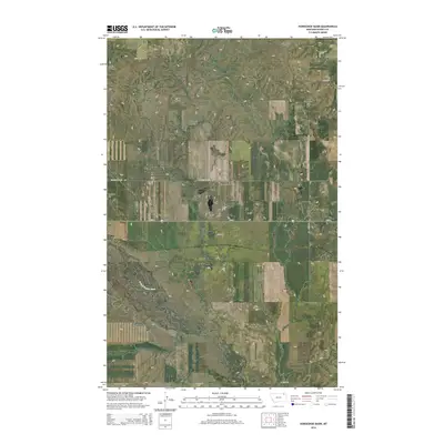
2014 Map of Horseshoe Basin
USGS Topo · Published 2014About this map
Horseshoe Basin defines the central topography of this northeastern Montana landscape, where the high plains are carved by a network of drainage coulees. The W Fork Poplar River meanders through the southern half of the quadrangle, drawing from tributaries like Blackhawk Coulee. This 2014 survey documents a rural environment structured by section lines and named country roads that speak to local land use, including Truax Rd, Gregerson Rd, and Butte Creek Rd. Prominent elevations such as Gregerson Hill and Richland Hill rise above the basin floor, providing clear landmarks in the open terrain. The mapping reflects the enduring ranching and agricultural grid of Daniels County, showing how modern corridors like MT-248 intersect with older routes like Horseshoe Basin Rd to connect this isolated corner of the state.
Find a feature on this map
18 named features on this map. Tap any name to fly to it.
Don’t see what you’re looking for? This feature index may not catch every label — zoom into the map to look around manually.
Map Details
Editions of this 2014 Horseshoe Basin Map
This is the sole edition of this map. No revisions or reprints were ever made.
Other maps of this area

1954 · Wolf Point
USGS Topo · 1:250,000

1954 · Glasgow
USGS Topo · 1:250,000

1957 · Glasgow
USGS Topo · 1:250,000

1958 · Wolf Point
USGS Topo · 1:250,000

1958 · Glasgow
USGS Topo · 1:250,000

1973 · Horseshoe Basin
USGS Topo · 1:24,000

1973 · Brockway Spring
USGS Topo · 1:24,000

1973 · West Fork NE
USGS Topo · 1:24,000

1973 · Peerless
USGS Topo · 1:24,000

1973 · Flaherty Coulee
USGS Topo · 1:24,000