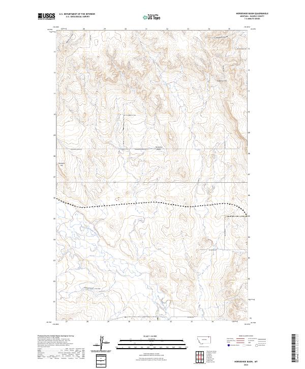
2024 Map of Horseshoe Basin
USGS Topo · Published 2024About this map
The West Fork Poplar River meanders through this portion of Daniels County, defining a landscape of high plains drainage and subtle topographic rises. The namesake Horseshoe Basin sits at the heart of the quadrangle, surrounded by landmarks like Richland Hill and Gregerson Hill. This 2024 survey reflects a modern view of the region's rural infrastructure, where long-established section-line roads like Truax Rd and Kleeman Rd provide access to the vast agricultural stretches of the Missouri River basin. The map detail highlights the intricate drainage patterns of Blackhawk Coulee, Martin Coulee, and Lewarton Coulee, illustrating how water has shaped the terrain over time. This data is essential for understanding the contemporary geography of Northeastern Montana, preserving the specific placement of rural routes such as Railroad Rd and Horseshoe Basin Rd.
Find a feature on this map
18 named features on this map. Tap any name to fly to it.
Don’t see what you’re looking for? This feature index may not catch every label — zoom into the map to look around manually.
Map Details
Editions of this 2024 Horseshoe Basin Map
This is the sole edition of this map. No revisions or reprints were ever made.
Other maps of this area

1954 · Wolf Point
USGS Topo · 1:250,000

1954 · Glasgow
USGS Topo · 1:250,000

1957 · Glasgow
USGS Topo · 1:250,000

1958 · Wolf Point
USGS Topo · 1:250,000

1958 · Glasgow
USGS Topo · 1:250,000

1973 · Horseshoe Basin
USGS Topo · 1:24,000

1973 · Brockway Spring
USGS Topo · 1:24,000

1973 · West Fork NE
USGS Topo · 1:24,000

1973 · Peerless
USGS Topo · 1:24,000

1973 · Flaherty Coulee
USGS Topo · 1:24,000