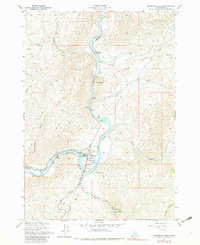
1957 Map of Horseshoe Bend
USGS Topo · Published 1982About this map
Horseshoe Bend occupies a sharp meander in the Payette River, serving as a focal point for industrial and transit activity in the mid-20th century. The settlement’s economy is defined by its timber and water infrastructure, featuring a Diversion Dam, a large Millpond, and several additional Millponds near the Union Pacific rail line. To the north, the small settlement of Gardena sits along the river, while the local geography is carved by steep drainages like Porter Creek and Jackass Creek. The presence of the Pioneer Cemetery and old mining sites such as a Prospect and a Mine on the western slopes suggest early pioneer roots and resource extraction that predated the industrial timber operations. To the south, the Shafer Creek Road winds through the hills, providing access to the high country of South Mtn and the broad Jerusalem Valley.
Find a feature on this map
27 named features on this map. Tap any name to fly to it.
Don’t see what you’re looking for? This feature index may not catch every label — zoom into the map to look around manually.
Map Details
Editions of this 1957 Horseshoe Bend Map
3 editions found
Other maps of this area

1892 · Boise
USGS Topo · 1:125,000

1894 · Squaw Creek
USGS Topo · 1:125,000

1897 · Boise
USGS Topo · 1:125,000

1953 · Banks
USGS Topo · 1:62,500

1953 · Montour
USGS Topo · 1:62,500

1955 · Baker
USGS Topo · 1:250,000

1955 · Boise
USGS Topo · 1:250,000

1957 · Cartwright Canyon
USGS Topo · 1:24,000

1957 · Horseshoe Bend
USGS Topo · 1:24,000
1957 · Shafer Butte
USGS Topo · 1:24,000