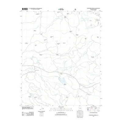
2011 Map of Horseshoe Cienega
USGS Topo · Published 2011About this map
Horseshoe Cienega and its high-elevation wetlands define this landscape in Apache County, where numerous springs and tanks support a network of creeks and alpine cienegas. The area is marked by significant topographical features including Penrod Mountain, Cerro Gordon Mountain, and Cinder Point Mountain, reflecting a complex volcanic and hydrologic environment. Human presence is centered on managed forest sites and recreational areas such as Ryan Ranch, Thode Cabin, and the CC Fireman Cabin. Water management is evident through a density of named stock tanks like CC Tank Number One and Admen Tank. For those interested in the infrastructure of the White Mountains, the map details the location of McCoy Bridge and several specialized forest service locations, alongside public recreation spots at Horseshoe Cienega Lake Campground and Cyclone Lake Campground.
Find a feature on this map
83 named features on this map. Tap any name to fly to it.
Don’t see what you’re looking for? This feature index may not catch every label — zoom into the map to look around manually.
Map Details
Editions of this 2011 Horseshoe Cienega Map
This is the sole edition of this map. No revisions or reprints were ever made.
Other maps of this area

1886 · St Johns
USGS Topo · 1:250,000

1892 · St Johns
USGS Topo · 1:250,000

1954 · Clifton
USGS Topo · 1:250,000

1954 · Saint Johns
USGS Topo · 1:250,000

1957 · Clifton
USGS Topo · 1:250,000

1957 · Saint Johns
USGS Topo · 1:250,000

1958 · Clifton
USGS Topo · 1:250,000

1958 · Saint Johns
USGS Topo · 1:250,000

1961 · McNary
USGS Topo · 1:62,500

1962 · Clifton
USGS Topo · 1:250,000