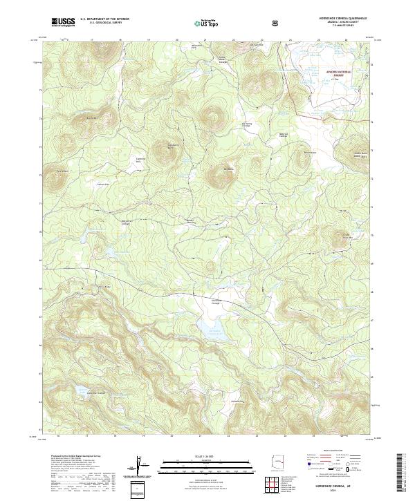
2021 Map of Horseshoe Cienega
USGS Topo · Published 2021About this map
Horseshoe Cienega Lake and the high-elevation wetlands of the Apache National Forest define this 2021 landscape in the White Mountains. The terrain is a complex network of volcanic buttes and seasonal water sources, featuring named marshes and flats like Old Corral Cienega and Penrod Flat. Infrastructure is sparse, primarily consisting of forest service roads such as Co RD 620 and local landmarks like McCoy Bridge, which crosses the southern drainage systems.
Find a feature on this map
86 named features on this map. Tap any name to fly to it.
Don’t see what you’re looking for? This feature index may not catch every label — zoom into the map to look around manually.
Map Details
Editions of this 2021 Horseshoe Cienega Map
This is the sole edition of this map. No revisions or reprints were ever made.
Other maps of this area

1886 · St Johns
USGS Topo · 1:250,000

1892 · St Johns
USGS Topo · 1:250,000

1954 · Clifton
USGS Topo · 1:250,000

1954 · Saint Johns
USGS Topo · 1:250,000

1957 · Clifton
USGS Topo · 1:250,000

1957 · Saint Johns
USGS Topo · 1:250,000

1958 · Clifton
USGS Topo · 1:250,000

1958 · Saint Johns
USGS Topo · 1:250,000

1961 · McNary
USGS Topo · 1:62,500

1962 · Clifton
USGS Topo · 1:250,000