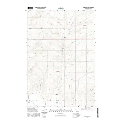
2017 Map of Horseshoe Creek
USGS Topo · Published 2017About this map
Edilou and the neighboring community of Hillman sit at the southern edge of this Gallatin County survey, where the terrain begins to transition from the river valley toward the elevated draws of the Horseshoe Hills. In the north, the small settlement of Menard and the nearby Menard Wye mark a historic junction of travel routes including Menard Rd and Pass Creek Rd. The landscape is defined by its drainage systems, with Dry Creek and Menard Creek carving paths through the rolling topography toward the East Gallatin River at Spaulding Bridge. Genealogists will find notable sites like the Dry Creek Cemetery near Pheasant Lane and the isolated Fly Cemetery to the west. Distinctive geographical features like Chipmunk Gulch and Little Horseshoe Basin provide a detailed look at the area's natural landmarks between the ridges of Little Round Mountain.
Find a feature on this map
47 named features on this map. Tap any name to fly to it.
Don’t see what you’re looking for? This feature index may not catch every label — zoom into the map to look around manually.
Map Details
Editions of this 2017 Horseshoe Creek Map
This is the sole edition of this map. No revisions or reprints were ever made.
Other maps of this area

1886 · Fort Logan
USGS Topo · 1:250,000

1888 · Three Forks
USGS Topo · 1:250,000

1894 · Three Forks
USGS Topo · 1:250,000

1895 · Three Forks
USGS Topo · 1:250,000

1947 · Bozeman
USGS Topo · 1:250,000

1948 · Bozeman
USGS Topo · 1:250,000

1948 · White Sulphur Springs
USGS Topo · 1:250,000

1949 · Manhattan
USGS Topo · 1:62,500

1949 · Maudlow
USGS Topo · 1:62,500

1949 · Toston
USGS Topo · 1:62,500