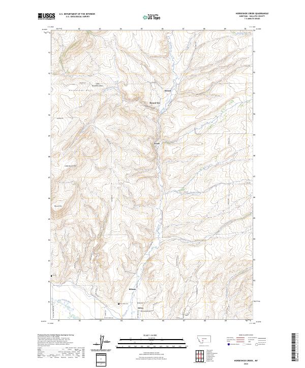
2024 Map of Horseshoe Creek
USGS Topo · Published 2024About this map
The Horseshoe Hills dominate the northern landscape of this region, where the drainages of Menard Creek and Dry Creek carve through the terrain. Small rural clusters like Menard, Accola, and Menard Wye reflect the agricultural and ranching patterns of the valley, connected by a network of local routes such as Skinner Rd and Pass Creek Rd. To the south, the terrain softens as it approaches the East Gallatin River. This map is particularly valuable for genealogists, as it identifies localized burial grounds including Dry Creek Cem near the Edilou area and the more remote Fly Cem further west. Landforms like Little Round Mtn and Round Mtn serve as distinct markers for those tracing property boundaries or historical travel routes through the gulches.
Find a feature on this map
48 named features on this map. Tap any name to fly to it.
Don’t see what you’re looking for? This feature index may not catch every label — zoom into the map to look around manually.
Map Details
Editions of this 2024 Horseshoe Creek Map
This is the sole edition of this map. No revisions or reprints were ever made.
Other maps of this area

1886 · Fort Logan
USGS Topo · 1:250,000

1888 · Three Forks
USGS Topo · 1:250,000

1894 · Three Forks
USGS Topo · 1:250,000

1895 · Three Forks
USGS Topo · 1:250,000

1947 · Bozeman
USGS Topo · 1:250,000

1948 · Bozeman
USGS Topo · 1:250,000

1948 · White Sulphur Springs
USGS Topo · 1:250,000

1949 · Manhattan
USGS Topo · 1:62,500

1949 · Maudlow
USGS Topo · 1:62,500

1949 · Toston
USGS Topo · 1:62,500