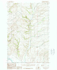
1987 Map of Horseshoe Creek
USGS Topo · Published 1987About this map
Menard stands as a focal point of settlement in this northern Gallatin County landscape, where the high ridges of the Horseshoe Hills meet the branching drainages of the East Gallatin River. The terrain is deeply inscribed by seasonal and perennial waterways, most notably Dry Creek and its many tributaries like Mill Creek and Reynolds Creek.
Find a feature on this map
20 named features on this map. Tap any name to fly to it.
Don’t see what you’re looking for? This feature index may not catch every label — zoom into the map to look around manually.
Map Details
Editions of this 1987 Horseshoe Creek Map
This is the sole edition of this map. No revisions or reprints were ever made.
Other maps of this area

1886 · Fort Logan
USGS Topo · 1:250,000

1888 · Three Forks
USGS Topo · 1:250,000

1894 · Three Forks
USGS Topo · 1:250,000

1895 · Three Forks
USGS Topo · 1:250,000

1947 · Bozeman
USGS Topo · 1:250,000

1948 · Bozeman
USGS Topo · 1:250,000

1948 · White Sulphur Springs
USGS Topo · 1:250,000

1949 · Manhattan
USGS Topo · 1:62,500

1949 · Maudlow
USGS Topo · 1:62,500

1949 · Toston
USGS Topo · 1:62,500