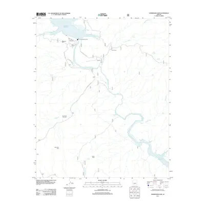
2011 Map of Horseshoe Dam
USGS Topo · Published 2011About this map
Horseshoe Dam stands as the central engineering feature of this Arizona landscape, managing the flow of the Verde River as it passes from Horseshoe Reservoir toward the northern reaches of Bartlett Reservoir. This 2011 survey documents the infrastructure of the Salt River Project Housing Area and the K A Ranch along the river banks. The terrain is marked by significant elevation changes, from the heights of Saint Clair Mountain and Saint Clair Peak to the broad expanses of Mesquite Flat. Water remains the primary narrative of this region, evidenced by the numerous named water sources such as J M Spring, Cholla Spring, and the seasonally active Indian Spring Wash. The presence of the Sears Trailhead indicates the area's role in modern recreational land use within the larger river corridor.
Find a feature on this map
31 named features on this map. Tap any name to fly to it.
Don’t see what you’re looking for? This feature index may not catch every label — zoom into the map to look around manually.
Map Details
Editions of this 2011 Horseshoe Dam Map
This is the sole edition of this map. No revisions or reprints were ever made.
Other maps of this area

1887 · Verde
USGS Topo · 1:250,000

1892 · Verde
USGS Topo · 1:250,000

1929 · Turret Peak
USGS Topo · 1:125,000

1930 · Cave Creek
USGS Topo · 1:125,000

1933 · Turret Peak
USGS Topo · 1:125,000

1939 · Cave Creek
USGS Topo · 1:125,000

1954 · Holbrook
USGS Topo · 1:250,000

1954 · Mesa
USGS Topo · 1:250,000

1957 · Mesa
USGS Topo · 1:250,000

1957 · Holbrook
USGS Topo · 1:250,000