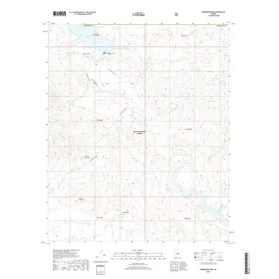
2018 Map of Horseshoe Dam
USGS Topo · Published 2018About this map
Horseshoe Dam anchors this high-desert landscape in northern Maricopa County, where the impounded Horseshoe Reservoir provides a critical water source for the region. The map details a rugged area within the Tonto National Forest defined by the winding course of the Verde River. Named peaks such as Saint Clair Mtn, Saint Clair Peak, and Indian Butte dominate the topography, while numerous water sources like Saint Clair Spring and Cholla Spring reveal the essential hydrology of the arid terrain.
Find a feature on this map
35 named features on this map. Tap any name to fly to it.
Don’t see what you’re looking for? This feature index may not catch every label — zoom into the map to look around manually.
Map Details
Editions of this 2018 Horseshoe Dam Map
This is the sole edition of this map. No revisions or reprints were ever made.
Other maps of this area

1887 · Verde
USGS Topo · 1:250,000

1892 · Verde
USGS Topo · 1:250,000

1929 · Turret Peak
USGS Topo · 1:125,000

1930 · Cave Creek
USGS Topo · 1:125,000

1933 · Turret Peak
USGS Topo · 1:125,000

1939 · Cave Creek
USGS Topo · 1:125,000

1954 · Holbrook
USGS Topo · 1:250,000

1954 · Mesa
USGS Topo · 1:250,000

1957 · Mesa
USGS Topo · 1:250,000

1957 · Holbrook
USGS Topo · 1:250,000