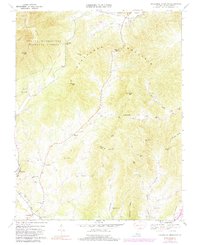
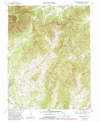
1967 Map of Horseshoe Mountain
USGS Topo · Published 1991About this map
Massies Mill serves as a focal point in the Tye River valley, where agricultural lands meet the rising elevation of the Blue Ridge Mountains. This late-1960s landscape shows a community oriented around the river and its tributaries, with local institutions like the Massies Mill Sch and Massie Memorial Ch anchoring the settlement. To the west, the Appalachian Trail winds through the George Washington National Forest, crossing heights such as Horseshoe Mountain and Three Ridges.
Find a feature on this map
42 named features on this map. Tap any name to fly to it.
Don’t see what you’re looking for? This feature index may not catch every label — zoom into the map to look around manually.
Map Details
Editions of this 1967 Horseshoe Mountain Map
5 editions found
Other maps of this area

1892 · Buckingham
USGS Topo · 1:125,000

1894 · Lexington
USGS Topo · 1:125,000

1935 · Amherst
USGS Topo · 1:48,000

1936 · Vesuvius
USGS Topo · 1:48,000

1939 · Amherst
USGS Topo · 1:62,500

1941 · Vesuvius
USGS Topo · 1:62,500

1943 · Lovingston
USGS Topo · 1:62,500

1946 · Lovingston
USGS Topo · 1:62,500

1947 · Roanoke
USGS Topo · 1:250,000

1950 · Amherst
USGS Topo · 1:62,500