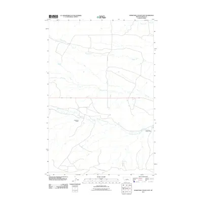
2011 Map of Horsethief Coulee East
USGS Topo · Published 2011About this map
North Fork McDonald Creek meanders through this portion of Fergus County, defining a drainage pattern that has long shaped local land use. This 2011 survey illustrates the rural character of the Big Snowy Mountains foothills, where the Ayers Colony Number 1 Dam manages water resources in an arid landscape. The terrain is marked by distinctive geological features like Horsethief Coulee, which cuts through the plains south of Alkali Creek. A network of secondary routes, including Burnett Rd and Forest Grove Rd, provides access across the drainage basins of Chippewa Creek and Fords Creek. This layout reveals the persistent ranching and agricultural framework of central Montana, where water management and natural coulees dictate the placement of roads and homesteads.
Find a feature on this map
9 named features on this map. Tap any name to fly to it.
Don’t see what you’re looking for? This feature index may not catch every label — zoom into the map to look around manually.
Map Details
Editions of this 2011 Horsethief Coulee East Map
This is the sole edition of this map. No revisions or reprints were ever made.
Other maps of this area

1889 · Big Snowy Mountain
USGS Topo · 1:250,000

1893 · Big Snowy Mountain
USGS Topo · 1:250,000

1941 · Judith Peak
USGS Topo · 1:62,500

1944 · Judith Peak
USGS Topo · 1:62,500

1954 · Roundup
USGS Topo · 1:250,000

1954 · Lewistown
USGS Topo · 1:250,000

1958 · Roundup
USGS Topo · 1:250,000

1959 · Lewistown
USGS Topo · 1:250,000

1970 · Forestgrove
USGS Topo · 1:24,000
1970 · Loco Ridge
USGS Topo · 1:24,000