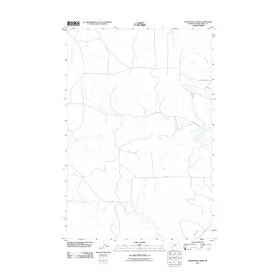
2011 Map of Horsethief Creek
USGS Topo · Published 2011About this map
Horsethief Creek meanders through this portion of Musselshell County, defining a landscape shaped by intermittent watercourses and rural access. The drainage network includes Alkali Creek to the northeast and Currant Creek in the south, illustrating the natural catchment patterns of this Montana region. A modest infrastructure of dirt and gravel roads, such as Stanley Creek Rd and Johnson Rd, provides the primary framework for local travel between ranchlands. In the lower southeast, the presence of the Naderman Ditch signifies the importance of water management for agriculture in an area where moisture is a critical resource. The proximity of Golf Course Rd in the northeast corner suggests localized development near more established settlements outside the immediate quadrangle boundaries.
Find a feature on this map
12 named features on this map. Tap any name to fly to it.
Don’t see what you’re looking for? This feature index may not catch every label — zoom into the map to look around manually.
Map Details
Editions of this 2011 Horsethief Creek Map
This is the sole edition of this map. No revisions or reprints were ever made.
Other maps of this area

1954 · Roundup
USGS Topo · 1:250,000

1958 · Roundup
USGS Topo · 1:250,000

1979 · Roundup
USGS Topo · 1:100,000

1979 · Bundy
USGS Topo · 1:24,000

1979 · Timber Buttes South
USGS Topo · 1:24,000

1979 · Harper Coulee
USGS Topo · 1:24,000

1979 · Elso
USGS Topo · 1:24,000

1979 · Horsethief Creek
USGS Topo · 1:24,000

1979 · Roundup
USGS Topo · 1:24,000

1986 · Lake Mason SE
USGS Topo · 1:24,000