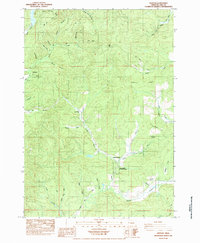
1984 Map of Horton
USGS Topo · Published 1984About this map
The Long Tom River carves a distinctive valley through this portion of Lane County, where the 1980s landscape is defined by its drainage systems and small settlements. The community of Horton sits in the northwest near Village Cr, while Low Pass marks a key transit point further south along the divide between watershed basins. This provisional survey captures the transition between the South Fork Alsea River headwaters and the southern reaches of the Ferguson Creek system.
Find a feature on this map
39 named features on this map. Tap any name to fly to it.
Don’t see what you’re looking for? This feature index may not catch every label — zoom into the map to look around manually.
Map Details
Editions of this 1984 Horton Map
This is the sole edition of this map. No revisions or reprints were ever made.
Other maps of this area

1909 · Elmira
USGS Topo · 1:62,500

1911 · Monroe
USGS Topo · 1:31,680

1922 · Monroe
USGS Topo · 1:62,500

1922 · Elmira
USGS Topo · 1:62,500

1939 · Monroe
USGS Topo · 1:62,500

1941 · Blachly
USGS Topo · 1:62,500

1942 · Alsea
USGS Topo · 1:62,500

1942 · Elmira
USGS Topo · 1:62,500

1942 · Blachly
USGS Topo · 1:62,500

1942 · Monroe
USGS Topo · 1:62,500