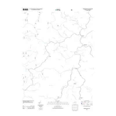
2013 Map of Hoskinston
USGS Topo · Published 2013About this map
The Middle-Fork-Kentucky River carves a winding path through this corner of Leslie County, dictating the placement of several small settlements and their post offices. Local communities like Stinnett, Hoskinson, Asher, and Mozelle are situated along the river's eastern banks, while Essie lies further west along the course of Stinnett Cr. The landscape is defined by an intricate network of narrow creek valleys, including Rockhouse Cr and Little Stinnett Cr, which branch off the main waterway like capillaries.
Find a feature on this map
56 named features on this map. Tap any name to fly to it.
Don’t see what you’re looking for? This feature index may not catch every label — zoom into the map to look around manually.
Map Details
Editions of this 2013 Hoskinston Map
This is the sole edition of this map. No revisions or reprints were ever made.
Other maps of this area

1886 · Cumberland Gap
USGS Topo · 1:125,000

1887 · Jonesville
USGS Topo · 1:125,000

1888 · Cumberland Gap
USGS Topo · 1:125,000

1891 · Manchester
USGS Topo · 1:125,000

1891 · Cumberland Gap
USGS Topo · 1:125,000

1891 · Hazard
USGS Topo · 1:125,000

1891 · Jonesville
USGS Topo · 1:125,000
1903 · Harlan
USGS Topo · 1:48,000
1903 · Pineville
USGS Topo · 1:48,000
1916 · Harlan
USGS Topo · 1:48,000