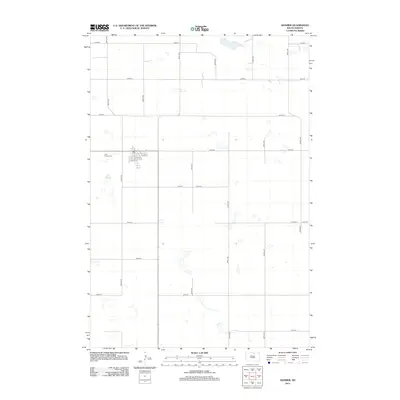
2012 Map of Hosmer
USGS Topo · Published 2012About this map
Hosmer sits at the center of this rural prairie landscape, positioned along a grid of section-line roads that define the region's agricultural layout. The settlement layout is anchored by several residential and commercial corridors, including E 5th St, E 6th St, and 7th St. On the western edge of the town site lies the Holy Trinity Cem, serving as a primary local landmark for genealogical research. The surrounding terrain is characteristic of the Missouri Coteau, marked by numerous small, scattered wetlands and depressions that interrupt the straight paths of roads like 335th Ave and 122nd St. This 2012 representation reflects the modern rural infrastructure of Edmunds County, showing the persistent patterns of land division and the essential transportation network connecting isolated farmsteads.
Find a feature on this map
21 named features on this map. Tap any name to fly to it.
Don’t see what you’re looking for? This feature index may not catch every label — zoom into the map to look around manually.
Map Details
Editions of this 2012 Hosmer Map
This is the sole edition of this map. No revisions or reprints were ever made.
Other maps of this area

1954 · Aberdeen
USGS Topo · 1:250,000

1956 · Aberdeen
USGS Topo · 1:250,000

1974 · Gretna
USGS Topo · 1:24,000

1974 · Roscoe
USGS Topo · 1:24,000

1978 · Hillsview SE
USGS Topo · 1:24,000

1978 · Roscoe NW
USGS Topo · 1:24,000

1978 · Hosmer NW
USGS Topo · 1:24,000

1978 · Hosmer NE
USGS Topo · 1:24,000

1978 · Hosmer SE
USGS Topo · 1:24,000

1978 · Hosmer
USGS Topo · 1:24,000