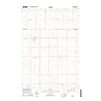
2015 Map of Hosmer
USGS Topo · Published 2015About this map
Hosmer serves as the central hub of this prairie landscape, situated exactly on the border of McPherson and Edmunds counties. The grid of the town is well-defined by the meeting of West Main Street and East Main Street, with the surrounding countryside organized into a precise network of section-line roads like 336th Ave and 125th St. Just west of the primary residential area, the Holy Trinity Cemetery provides a focal point for genealogical research and local history. The terrain is characterized by numerous small potholes and depressions common to the High Plains, with transit corridors like Cr-7 and 337th Ave linking isolated farmsteads across the township lines of T125N and T124N.
Find a feature on this map
32 named features on this map. Tap any name to fly to it.
Don’t see what you’re looking for? This feature index may not catch every label — zoom into the map to look around manually.
Map Details
Editions of this 2015 Hosmer Map
This is the sole edition of this map. No revisions or reprints were ever made.
Other maps of this area

1954 · Aberdeen
USGS Topo · 1:250,000

1956 · Aberdeen
USGS Topo · 1:250,000

1974 · Gretna
USGS Topo · 1:24,000

1974 · Roscoe
USGS Topo · 1:24,000

1978 · Hillsview SE
USGS Topo · 1:24,000

1978 · Roscoe NW
USGS Topo · 1:24,000

1978 · Hosmer NW
USGS Topo · 1:24,000

1978 · Hosmer NE
USGS Topo · 1:24,000

1978 · Hosmer SE
USGS Topo · 1:24,000

1978 · Hosmer
USGS Topo · 1:24,000