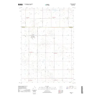
2017 Map of Hosmer
USGS Topo · Published 2017About this map
The town of Hosmer sits at the northern edge of Edmunds County, just below the Mcpherson Co Line. This prairie landscape is defined by a dense network of small wetlands and potholes, a characteristic of the Glacial Lake Agassiz region. The settlement serves as a local hub, with its core organized around W Main St, Main St, and Chapman Ave. Genealogy researchers will find several significant burial sites clustered near the town center, including Holy Trinity Cem on the western outskirts, and both Bethany Cem and Veterans Post 189 Cem located to the south. The surrounding township is neatly divided by an extensive grid of section-line roads, such as 337th Ave and 125th St, illustrating the enduring influence of the Public Land Survey System on South Dakota's agricultural geography.
Find a feature on this map
38 named features on this map. Tap any name to fly to it.
Don’t see what you’re looking for? This feature index may not catch every label — zoom into the map to look around manually.
Map Details
Editions of this 2017 Hosmer Map
This is the sole edition of this map. No revisions or reprints were ever made.
Other maps of this area

1954 · Aberdeen
USGS Topo · 1:250,000

1956 · Aberdeen
USGS Topo · 1:250,000

1974 · Gretna
USGS Topo · 1:24,000

1974 · Roscoe
USGS Topo · 1:24,000

1978 · Hillsview SE
USGS Topo · 1:24,000

1978 · Roscoe NW
USGS Topo · 1:24,000

1978 · Hosmer NW
USGS Topo · 1:24,000

1978 · Hosmer NE
USGS Topo · 1:24,000

1978 · Hosmer SE
USGS Topo · 1:24,000

1978 · Hosmer
USGS Topo · 1:24,000