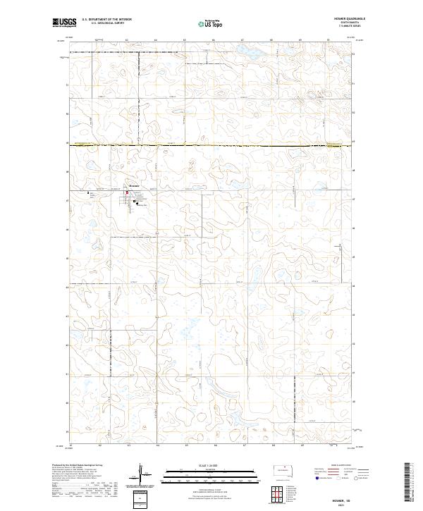
2021 Map of Hosmer
USGS Topo · Published 2021About this map
Hosmer serves as the central hub of this prairie landscape at the intersection of Main St and Chapman Ave. The town's layout reflects a traditional grid typical of rural South Dakota settlements, with local institutional history preserved at the Bethany Cem and Holy Trinity Cem. Outside the village center, the map illustrates the expansive township and range system, specifically where McPherson Co meets Edmunds Co. The surrounding territory is characterized by numerous small glacial depressions and wetlands that punctuate the agricultural sections. A notable local landmark is the Veterans Post 189 Cem located just south of the main residential streets. Access across the county line is facilitated by arterial routes like Co Hwy 7 and Co Hwy 9, which connect the remote farmsteads to the commercial heart of the township.
Find a feature on this map
36 named features on this map. Tap any name to fly to it.
Don’t see what you’re looking for? This feature index may not catch every label — zoom into the map to look around manually.
Map Details
Editions of this 2021 Hosmer Map
This is the sole edition of this map. No revisions or reprints were ever made.
Other maps of this area

1954 · Aberdeen
USGS Topo · 1:250,000

1956 · Aberdeen
USGS Topo · 1:250,000

1974 · Gretna
USGS Topo · 1:24,000

1974 · Roscoe
USGS Topo · 1:24,000

1978 · Hillsview SE
USGS Topo · 1:24,000

1978 · Roscoe NW
USGS Topo · 1:24,000

1978 · Hosmer NW
USGS Topo · 1:24,000

1978 · Hosmer NE
USGS Topo · 1:24,000

1978 · Hosmer SE
USGS Topo · 1:24,000

1978 · Hosmer
USGS Topo · 1:24,000