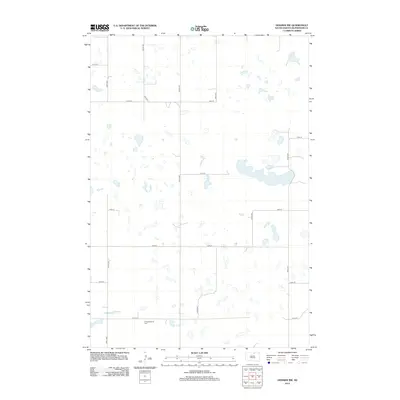
2012 Map of Hosmer NW
USGS Topo · Published 2012About this map
Glacial potholes and small prairie lakes define the landscape of McPherson County in this 2012 topographic study. The rural terrain is structured by a precise grid of gravel and section roads, including 335th Ave and 115th St, which navigate between countless unnamed wetlands and depressions characteristic of the Missouri Coteau. Near the southern edge of the sheet, the Congregational Cem serves as a significant landmark for genealogists and local historians, sitting just north of 121st St. This area, accessed primarily by Co Hwy 7, remains a sparsely populated agricultural region where the natural hydrology of the Great Plains dictates the placement of transit corridors and land use.
Find a feature on this map
15 named features on this map. Tap any name to fly to it.
Don’t see what you’re looking for? This feature index may not catch every label — zoom into the map to look around manually.
Map Details
Editions of this 2012 Hosmer NW Map
This is the sole edition of this map. No revisions or reprints were ever made.
Other maps of this area

1954 · Aberdeen
USGS Topo · 1:250,000

1956 · Aberdeen
USGS Topo · 1:250,000

1978 · Hillsview SE
USGS Topo · 1:24,000

1978 · Hosmer NW
USGS Topo · 1:24,000

1978 · Hosmer NE
USGS Topo · 1:24,000

1978 · Hosmer SE
USGS Topo · 1:24,000

1978 · Eureka East
USGS Topo · 1:24,000

1978 · Hosmer
USGS Topo · 1:24,000

1978 · Schumacher Lake
USGS Topo · 1:24,000

1978 · Schumacher Lake SW
USGS Topo · 1:24,000