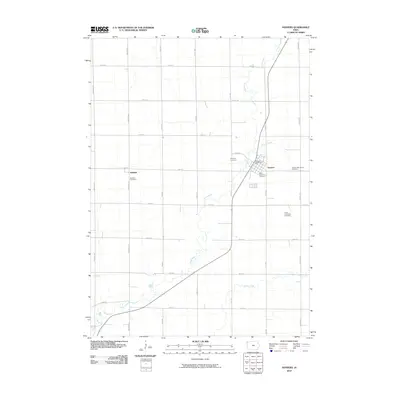
2010 Map of Hospers
USGS Topo · Published 2010About this map
Hospers serves as the primary hub of activity in this section of Sioux County, where the town grid is oriented along the diagonal path of the railroad and the Floyd River. This 2010 survey illustrates a landscape deeply rooted in the agrarian section-line grid of northwest Iowa, punctuated by small community clusters and an unusual density of burial grounds. Near the town center, researchers will find Saint Anthonys Cemetery and the Hospers Memorial Cemetery, while the Hospers Cemetery sits just to the west. To the west, the settlement of Newkirk remains a distinct landmark, marked by its own Newkirk Cemetery. The drainage patterns of Willow Creek wind across the eastern townships, providing a natural contrast to the rigid geometry of the surrounding gravel roads and farmland.
Find a feature on this map
26 named features on this map. Tap any name to fly to it.
Don’t see what you’re looking for? This feature index may not catch every label — zoom into the map to look around manually.
Map Details
Editions of this 2010 Hospers Map
This is the sole edition of this map. No revisions or reprints were ever made.
Other maps of this area

1954 · Fairmont
USGS Topo · 1:250,000

1954 · Fort Dodge
USGS Topo · 1:250,000

1955 · Sioux City
USGS Topo · 1:250,000

1955 · Sioux Falls
USGS Topo · 1:250,000

1957 · Fort Dodge
USGS Topo · 1:250,000

1958 · Sioux City
USGS Topo · 1:250,000

1958 · Sioux Falls
USGS Topo · 1:250,000

1958 · Fort Dodge
USGS Topo · 1:250,000

1958 · Fairmont
USGS Topo · 1:250,000

1959 · Sioux City
USGS Topo · 1:250,000