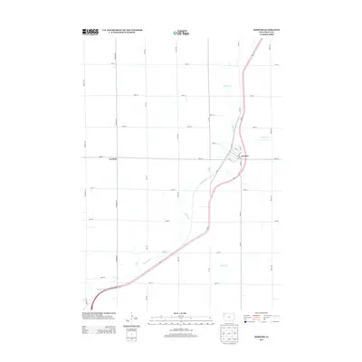
2013 Map of Hospers
USGS Topo · Published 2013About this map
The Floyd River meanders southwestward across this Sioux County landscape, carving a gentle valley through a strictly regulated grid of section-line roads and agricultural tracts. At the center of this rural network lies Hospers, a settlement defined by a traditional street plan featuring Main St, Cedar St, and Pine St. The town is positioned along a primary corridor where Co Rd N and Co Rd S meet the local thoroughfares, illustrating the importance of road connectivity in the regional trade economy. To the west, the smaller community of Newkirk sits at the intersection of 400th St and Kingbird Ave, anchoring the surrounding farms. Secondary drainage is provided by Willow Cr, which feeds into the larger river system. The 2013 landscape shows a high degree of land management, with named avenues like Larch Ave and Lily Ave providing access to the fertile plains between the watercourses.
Find a feature on this map
29 named features on this map. Tap any name to fly to it.
Don’t see what you’re looking for? This feature index may not catch every label — zoom into the map to look around manually.
Map Details
Editions of this 2013 Hospers Map
This is the sole edition of this map. No revisions or reprints were ever made.
Other maps of this area

1954 · Fairmont
USGS Topo · 1:250,000

1954 · Fort Dodge
USGS Topo · 1:250,000

1955 · Sioux City
USGS Topo · 1:250,000

1955 · Sioux Falls
USGS Topo · 1:250,000

1957 · Fort Dodge
USGS Topo · 1:250,000

1958 · Sioux City
USGS Topo · 1:250,000

1958 · Sioux Falls
USGS Topo · 1:250,000

1958 · Fort Dodge
USGS Topo · 1:250,000

1958 · Fairmont
USGS Topo · 1:250,000

1959 · Sioux City
USGS Topo · 1:250,000