
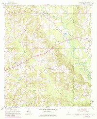
1965 Map of Hot Coffee
USGS Topo · Published 1966About this map
The unincorporated community of Hot Coffee sits in the northwest of this survey, a crossroads marked by the Calhoun Ch and its cemetery. This section of Mississippi, straddling the Covington Co and Jones Co line, is defined by the winding course of the Leaf River and its numerous oxbow lakes, including Speed Lake, Clear Lake, and Scruggs Lake. The landscape is a patchwork of timbered hills and agricultural clearings, with rural life anchored by institutions like the Hopewell Sch and Leaf River Ch.
Find a feature on this map
46 named features on this map. Tap any name to fly to it.
Don’t see what you’re looking for? This feature index may not catch every label — zoom into the map to look around manually.
Map Details
Editions of this 1965 Hot Coffee Map
2 editions found
Other maps of this area

1953 · Hattiesburg
USGS Topo · 1:250,000

1958 · Hattiesburg
USGS Topo · 1:250,000

1964 · Seminary
USGS Topo · 1:24,000

1965 · Hebron
USGS Topo · 1:24,000

1965 · Moselle
USGS Topo · 1:24,000

1974 · Williamsburg
USGS Topo · 1:24,000

1974 · Soso
USGS Topo · 1:24,000

1974 · Collins
USGS Topo · 1:24,000

1975 · Taylorsville
USGS Topo · 1:24,000

1975 · Mize
USGS Topo · 1:24,000