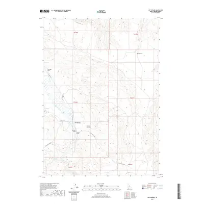
2020 Map of Hot Springs
USGS Topo · Published 2020About this map
Hot Springs serves as the focal point of this arid valley floor, situated where the geothermal activity of the high desert meets the Bruneau River. This 2020 topographic map illustrates a landscape defined by water management and natural springs, with infrastructure such as the Buckaroo Ditch and Hot Spring Canal diverting vital resources through the Bruneau Valley. The terrain rises sharply from the river bottom into deep incisions like Bruneau Canyon and Loveridge Gulch. Local history is anchored at the Hot Springs Cem, while the thermal features that give the area its name, including Pence Hot Spring and Falls Hot Springs, remain prominent landmarks. The network of unimproved roads and the Equine Loop Trail suggest a region primarily dedicated to ranching and recreation in the remote Owyhee backcountry.
Find a feature on this map
25 named features on this map. Tap any name to fly to it.
Don’t see what you’re looking for? This feature index may not catch every label — zoom into the map to look around manually.
Map Details
Editions of this 2020 Hot Springs Map
This is the sole edition of this map. No revisions or reprints were ever made.
Other maps of this area

1947 · Bruneau
USGS Topo · 1:62,500

1947 · Indian Cove
USGS Topo · 1:24,000

1947 · Sand Dunes
USGS Topo · 1:24,000

1947 · Bruneau
USGS Topo · 1:24,000

1947 · Sugar Valley
USGS Topo · 1:24,000

1947 · Hot Spring
USGS Topo · 1:24,000

1948 · Sand Dunes
USGS Topo · 1:24,000

1948 · Indian Cove
USGS Topo · 1:24,000

1948 · Sugar Valley
USGS Topo · 1:24,000
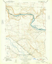
1948 · Bruneau
USGS Topo · 1:24,000