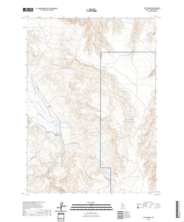
2024 Map of Hot Springs
USGS Topo · Published 2024About this map
Bruneau Valley serves as a verdant corridor through the high desert of Owyhee County, defined by the winding course of the Bruneau River. This 2024 survey illustrates a landscape where geothermal features and managed irrigation meet, centered on the small settlement of Hot Springs. The hydraulic engineering required for desert agriculture is evident in the presence of the Buckaroo Ditch and Hot Spring Canal, while the thermal activity that gives the area its name is marked at Pence Hot Spring and Falls Hot Springs.
Find a feature on this map
26 named features on this map. Tap any name to fly to it.
Don’t see what you’re looking for? This feature index may not catch every label — zoom into the map to look around manually.
Map Details
Editions of this 2024 Hot Springs Map
This is the sole edition of this map. No revisions or reprints were ever made.
Other maps of this area

1947 · Bruneau
USGS Topo · 1:62,500

1947 · Indian Cove
USGS Topo · 1:24,000

1947 · Sand Dunes
USGS Topo · 1:24,000

1947 · Bruneau
USGS Topo · 1:24,000

1947 · Sugar Valley
USGS Topo · 1:24,000

1947 · Hot Spring
USGS Topo · 1:24,000

1948 · Sand Dunes
USGS Topo · 1:24,000

1948 · Indian Cove
USGS Topo · 1:24,000

1948 · Sugar Valley
USGS Topo · 1:24,000
1948 · Bruneau
USGS Topo · 1:24,000