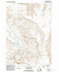
1992 Map of Hot Springs
USGS Topo · Published 1992About this map
Bruneau Valley serves as a stark oasis of water and thermal activity within the high desert landscape of Owyhee County. The Bruneau River winds through the southwestern corner, carving deep into the earth at Bruneau Canyon before flowing past the localized settlement of Hot Springs. Geothermal features are central to the area's identity, evidenced by labels for Pence Hot Spring and the curious Indian Bathtub south of the main road.
Find a feature on this map
30 named features on this map. Tap any name to fly to it.
Don’t see what you’re looking for? This feature index may not catch every label — zoom into the map to look around manually.
Map Details
Editions of this 1992 Hot Springs Map
This is the sole edition of this map. No revisions or reprints were ever made.
Other maps of this area

1947 · Bruneau
USGS Topo · 1:62,500

1947 · Indian Cove
USGS Topo · 1:24,000

1947 · Sand Dunes
USGS Topo · 1:24,000

1947 · Bruneau
USGS Topo · 1:24,000

1947 · Sugar Valley
USGS Topo · 1:24,000

1947 · Hot Spring
USGS Topo · 1:24,000

1948 · Sand Dunes
USGS Topo · 1:24,000

1948 · Indian Cove
USGS Topo · 1:24,000

1948 · Sugar Valley
USGS Topo · 1:24,000
1948 · Bruneau
USGS Topo · 1:24,000