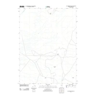
2011 Map of Hot Springs Peak
USGS Topo · Published 2011About this map
Hot Springs Peak dominates the northern elevation of this Nevada landscape, where the high desert terrain of Humboldt County meets a sparse but vital network of water sources. The Hot Springs Range stretches through the central portion of the map, creating a natural divide that funnels drainage into basins like Eden Valley. This 2011 survey captures the area's geological character, defined by the winding course of the Little Humboldt River in the northwest and the strategically located Stewart Gap. The distribution of seasonal water is evident through named features such as Reed Spring and Scott Spring, which have historically served as critical landmarks for travelers and ranchers navigating the arid corridors of Ling Canyon.
Find a feature on this map
8 named features on this map. Tap any name to fly to it.
Don’t see what you’re looking for? This feature index may not catch every label — zoom into the map to look around manually.
Map Details
Editions of this 2011 Hot Springs Peak Map
This is the sole edition of this map. No revisions or reprints were ever made.
Other maps of this area

1882 · Paradise
USGS Topo · 1:250,000

1893 · Paradise
USGS Topo · 1:250,000

1945 · Osgood Mountains
USGS Topo · 1:62,500

1945 · Hot Springs
USGS Topo · 1:62,500

1947 · Osgood Mountains
USGS Topo · 1:62,500

1947 · Hot Springs Peak
USGS Topo · 1:62,500

1955 · McDermitt
USGS Topo · 1:250,000

1958 · Paradise Valley
USGS Topo · 1:62,500

1959 · McDermitt
USGS Topo · 1:250,000

1959 · Bliss
USGS Topo · 1:62,500